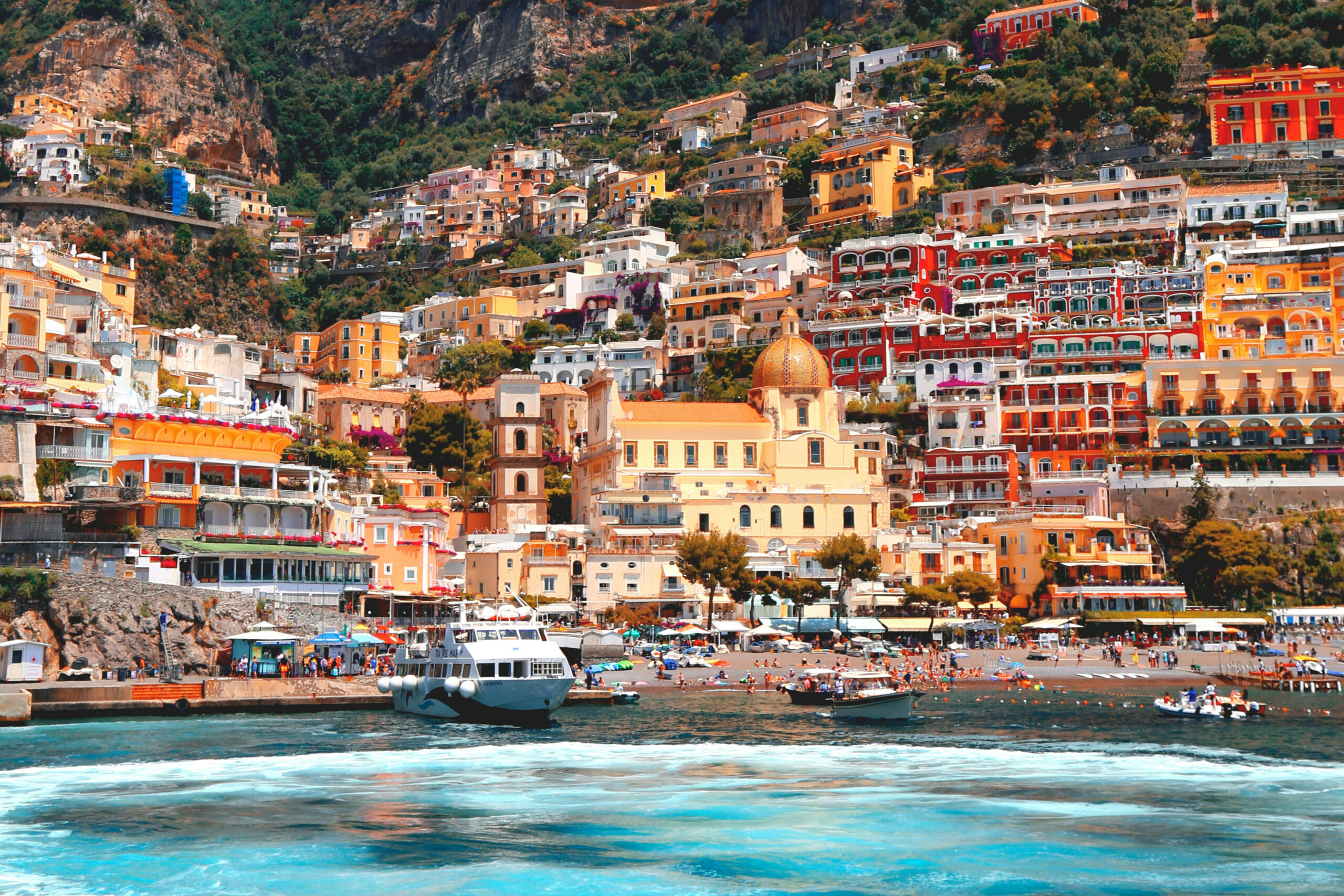
The Path of the Gods is one of the rare Amalfi Coast experiences where the landscape seems to become larger as everything else becomes simpler.
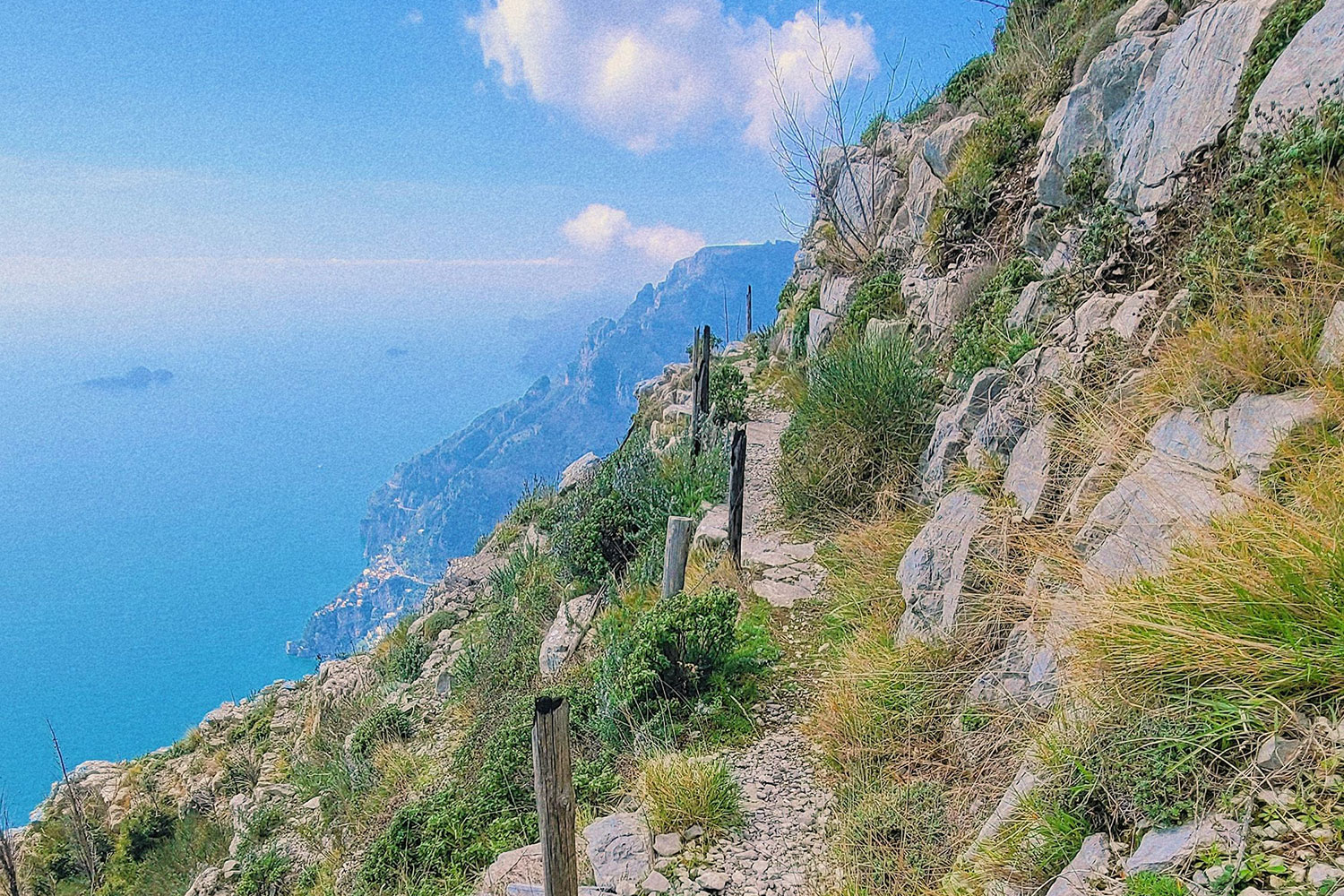
You begin in Bomerano with cafés, parked cars and village life around Piazza Paolo Capasso. A little later there is limestone under your shoes, terraces cut into the mountainside and a blue horizon stretching towards Positano, Li Galli and Capri.
The Italian name, Sentiero degli Dei, sounds theatrical. The walk earns it.
For most travellers, the best version is beautifully straightforward:
→ start in Bomerano
→ walk west towards Nocelle above Positano
→ then continue into Positano by local bus or on foot.
The part worth planning carefully comes around the walk itself — reaching Bomerano, understanding exactly where the trail begins, choosing between the upper and lower variants around Colle la Serra and deciding how you want to finish the day once you reach Nocelle.
This guide covers all of that.
Quick answer · Path of the Gods
Path of the Gods hike at a glance
For a first hike, this is the route that makes the most sense: begin high in Bomerano, follow the trail towards Nocelle and let the coast gradually open in front of you.
Why is it called the Path of the Gods?
Local legend says the gods crossed these mountains to save Ulysses from the Sirens, whose mythical home was associated with the Li Galli islands below. Their passage through the rugged landscape is said to have created the trail that became known as Il Sentiero degli Dei — the Path of the Gods.
Is the Path of the Gods worth doing?
Yes — especially when walking and landscapes already sound like a good way to spend half a day.
The appeal comes from perspective.
Most Amalfi Coast journeys happen along the water or on the SS163, where cliffs tower above you and towns appear one bend at a time.
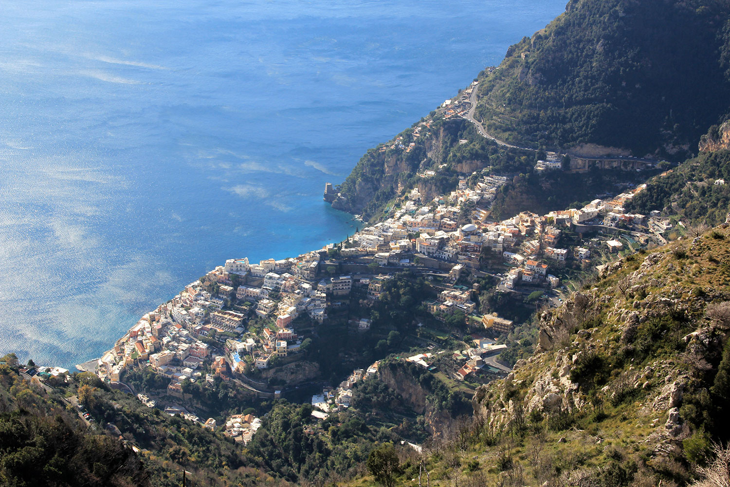
From the trail, Praiano looks tiny below you. Positano comes into view gradually, Li Galli sits offshore, and on a clear day you can see Capri beyond it.
The official Agerola route description highlights the same stretch of coastline, with views towards Positano, the Sorrentine Peninsula, Li Galli and Capri. Comune di Agerola — Sentiero degli Dei
Up here, the distances start to make more sense. Towns that look close on a map are separated by ridges, drops and long folds in the coast.
But what is the Path of the Gods, really?
The Path of the Gods — Sentiero degli Dei — is an old mountain trail high above the Amalfi Coast, once used by farmers, shepherds and local villagers long before the coastal road connected the towns below.
Today, the classic route runs from Bomerano to Nocelle, crossing terraces, rocky ridges and rural landscapes hundreds of metres above the sea. Its name is tied to the local legend that the gods crossed these mountains to save Ulysses from the Sirens.
What makes it special now is the mix of history, working landscape and huge coastal views. For a few hours, you are walking through the same mountains that shaped everyday life here for centuries.
Path of the Gods route: Bomerano to Nocelle
The classic walk begins at Piazza Paolo Capasso in Bomerano, a hamlet of Agerola.
📍 Open Piazza Paolo Capasso in Google Maps →
This is the most useful place to use as your starting point. Searching simply for “Path of the Gods” can bring up several trail entrances, viewpoints and businesses around the mountains.
From Piazza Paolo Capasso, follow Via Pennino towards the trail. The official Agerola route continues past Grotta del Biscotto before reaching Colle la Serra, at around 580 metres. Comune di Agerola — official Sentiero degli Dei route
By this point, the village is behind you and the trail begins to open properly towards the coast.
Interactive trail map
Interactive Path of the Gods map with elevation
Hover over the route to see elevation. On mobile, tap the trail.
The upper and lower Path of the Gods
Both routes begin in exactly the same place: Piazza Paolo Capasso in Bomerano.
From there, everyone follows the same trail past Grotta del Biscotto towards Colle la Serra. This is where the Path of the Gods divides into two variants.
↑ Upper route
The upper path stays higher on the mountainside. The ground is rougher in places and the route passes traces of old lime-production structures. Choose this one if you prefer staying higher and want to avoid some of the more exposed sections of the lower trail.
↓ Lower route
The lower path descends first and feels more open towards the sea. Some sections are more exposed, and this is also the variant that connects towards Convento di San Domenico and Vettica Maggiore. Choose it if you are comfortable with exposed mountain paths and want the more dramatic coastal feel.
→ Both routes meet again around Cannati, then continue along the same trail towards Nocelle.
For a first hike, there is no need to decide before you reach Colle la Serra. Follow the red-and-white CAI signs, look at the conditions when you arrive at the split, and choose the route that feels more comfortable that day.
Free · made exclusively by AmalfiMap
The Path of the Gods cheat sheet you won’t find anywhere else.
One page. Everything worth knowing before you start.
- The route, mapped clearly
- Stops worth knowing
- Local knowledge that matters
Free for the first 1,000 hikers · 800+ already have theirs.
Why does every website give a different distance?
This is one of the more confusing parts of planning the Path of the Gods.
You will see 5.3 km, 6 km, 7 km, 7.8 km and 8 km quoted for what looks like the same hike.
They are usually measuring slightly different versions of it.
The Italian Alpine Club (CAI) lists CAI trail 327 from Bomerano to Nocelle as 5.3 km, with the route reaching roughly 630 metres before finishing around 437 metres in Nocelle.
Meanwhile, Italia.it describes the broader Agerola–Nocelle experience as about 8 km and 4½ hours.
Other guides may include the walk from Piazza Paolo Capasso to the signed trail, one of the route variants, or part of the descent from Nocelle towards Positano.
The useful numbers
So, how long is the Path of the Gods actually?
Why the numbers vary: different sources measure slightly different starting points, trail variants and finishing points. For planning, these ranges are far more useful than chasing an exact GPS decimal.
How difficult is the Path of the Gods?
The Municipality of Positano classifies the Sentiero degli Dei as an E hiking route of medium difficulty. A fair description of what the trail actually feels like.
You do not need advanced hiking experience, but the route rewards steady footing, reasonable fitness and comfort on uneven mountain terrain. Some stretches run close to steep slopes, with open views directly down the mountainside.
Wear shoes with proper grip, choose a day with stable weather and give yourself enough time to walk without rushing.
The municipality also recommends suitable hiking equipment and favourable weather conditions.
No advanced hiking experience needed. Expect uneven mountain terrain, exposed sections and some steep drops. Good shoes, steady footing and reasonable fitness are enough for most hikers.
What the difficulty feels like in real life
The distance itself is manageable for many active travellers.
The terrain makes the walk feel different from an ordinary seven-kilometre city walk.
Expect:
- rocky and uneven sections;
- stone steps;
- modest climbs and descents;
- narrow sections;
- open cliffside views;
- plenty of places where slowing down improves both footing and photography.
If heights already feel comfortable to you, the exposure usually becomes part of what makes the route memorable.
If open mountain edges make your body tense before your mind has even made a decision, a lower walking route such as the Path of the Lemons may create a much more enjoyable day.
Which direction should you hike the Path of the Gods?
Bomerano → Nocelle is the direction I would recommend for most first-time hikers.
Starting in Bomerano means you begin high in the Lattari Mountains and gradually make your way towards Nocelle, with the Amalfi Coast opening up in front of you as you walk. The route feels natural, the views keep getting better, and you finish above Positano rather than having to climb back the way you came.
From Nocelle, you can continue down towards Positano and turn the hike into a full day on the coast. It gives the walk a really satisfying flow: Bomerano, mountain trail, panoramic views, Nocelle, Positano and finally the sea.
How to get to the Path of the Gods
This deserves almost as much attention as the trail.
Amalfi to Bomerano by SITA bus
For public transport, Amalfi is the most useful connection point for reaching the trail.
SITA Sud line 5080 runs from Amalfi through Conca dei Marini and Furore towards Agerola, including Bomerano. The current 2026 timetable covers the Amalfi–Agerola route. SITA Sud — official Amalfi Coast timetables
Use Bomerano / Piazza Paolo Capasso as your destination rather than simply “Agerola,” which covers several different hamlets.
SITA timetables change seasonally, so check the schedule again for your actual travel date.
The Travelmar ferry + Bomerano shuttle
During ferry season, there is another very practical option.
Travelmar offers a combined ferry + shuttle service to Bomerano: you travel by sea to Amalfi, then continue uphill by shuttle to Piazza Paolo Capasso. Travelmar currently lists connections from Salerno, Positano, Minori, Maiori, Cetara and Vietri sul Mare. Travelmar — official Path of the Gods ferry + shuttle information
For many travellers, this is the simplest way to reach the trail without changing buses.
For a summer hike, check the actual connection time before booking. Some combinations reach Bomerano later in the morning, so an earlier departure may suit you better.
From Positano
From Positano, you have several sensible ways to create the morning:
Public transport: travel to Amalfi, then continue to Agerola/Bomerano on line 5080.
Ferry season: use a Positano → Amalfi sailing and connect with the Bomerano shuttle where the schedule fits.
Private transfer: go directly to Bomerano and begin walking from Piazza Paolo Capasso.
The third option is especially attractive when you want a very early summer start.
After the hike, you finish above Positano rather than travelling all the way back to your starting point.
From Salerno
Travelmar’s combined service is particularly useful from Salerno because the ferry carries you to Amalfi and the connecting shuttle continues uphill towards Bomerano.
It turns a potentially awkward sequence into one planned connection.
Driving to Bomerano
Agerola has a “Sentiero degli Dei” parking area on Via Principe di Piemonte, referenced by the municipality itself.
The hike ends in Nocelle, so if you leave your car in Agerola, you will still need to get back to it after the walk.
For a point-to-point hike, public transport or a one-way transfer is usually the easier option and avoids having to retrace the route.
Along the trail
5 things worth slowing down for on the Path of the Gods
The sea views get most of the attention, but some of the best details are easy to walk straight past.
What happens at Nocelle after the Path of the Gods?
Nocelle is more than just the point where the trail ends.
It is Positano’s highest and oldest hamlet, sitting well above the coast with open views towards the sea, Montepertuso and the mountains behind it. After several hours on the trail, it is a good place to slow down for a few minutes, refill water, grab something cold and decide how you want to finish the day.
From here, you have two main options.
Walk down towards Positano. The municipality describes a staircase of around 1,700 steps connecting Nocelle with the coastal road near Arienzo. From there, you can continue towards Positano. It is a memorable finish, but after a long hike those steps can feel much harder than they sound.
Take the bus from Nocelle. This is the easier choice if your legs are done for the day. The local bus connects Nocelle with Positano, so you can still finish in town without adding a long descent on foot.
If you still have energy, walking down gives the hike a stronger sense of arrival. If not, taking the bus is completely reasonable — the main trail is already behind you.
Free · created by AmalfiMap
Take the Path of the Gods without figuring it out as you go.
A one-page field guide for a smoother hike.
- The route made simple
- What is actually worth stopping for
- Fewer decisions on the day
Only the first 1,000 get it free · already claimed by 800+ hikers.
Best time to hike the Path of the Gods
The best time to hike the Path of the Gods is spring and early autumn, when temperatures are comfortable, the mountains are green and visibility is often at its best.
May, early June, September and early October are the easiest periods to recommend. Days are long, the coast is fully active and you can usually hike without planning the whole day around the heat.
In July and August, the trail is still very doable, but start early. Large sections are exposed to direct sun and there is little shade once you move beyond Bomerano. An early start also means a quieter trail.
Winter can be beautiful on a clear, dry day, with fewer people and excellent visibility. The trade-off is shorter daylight and a greater chance of wind, rain or slippery sections.
More than any particular month, look for a dry day with clear visibility and light wind. Conditions high above the coast can be very different from those down in Positano.
Check trail conditions before you leave
The Path of the Gods is an active mountain trail, so conditions can change even when the route is generally open.
Maintenance, surface repairs or safety works can occasionally affect individual sections. Agerola temporarily rerouted parts of the trail during works in 2025, which is a useful reminder that the route you find online is not always the route you meet on the day.
Before leaving for Bomerano, check the latest notices from Comune di Agerola and Comune di Positano.
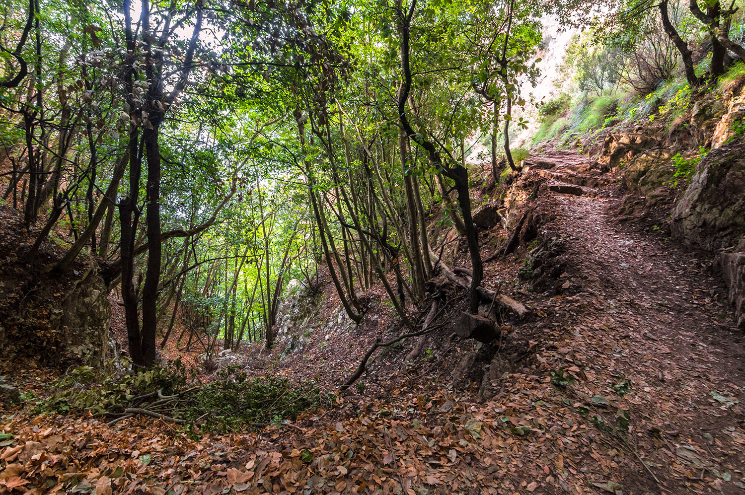
The Path of the Gods is not all open cliffs and sea views. Parts of the trail pass through quieter wooded sections of the Monti Lattari before opening back onto the coast. Photo: Stiflele / Wikimedia Commons, CC BY-SA 4.0. (commons.wikimedia.org)What to bring on the Path of the Gods
Keep the bag simple.
Shoes with proper grip
Light hiking shoes or sturdy trail shoes work beautifully for most people.
Traction matters more than owning expensive mountain equipment.
Enough water for several hours
The Municipality of Positano notes that potable water sources along the trail are limited.
Start comfortably supplied and treat any seasonal refreshment stop as a pleasant extra.
Sun protection
Large sections of the route feel wonderfully open.
Hat, sunscreen and sunglasses earn their space.
A light layer
Bomerano sits far higher than the beaches below, and a breeze on the mountain can feel very different from the temperature in Positano.
Something small to eat
A simple snack gives you the freedom to stop when the view tells you to rather than when a restaurant appears.
Should you hike the Path of the Gods with a guide?
Quick answer
Best if you are comfortable following marked trails, reading a map and arranging your own transport. The route has recognised CAI signage and is commonly walked without a guide.
Best if you want more context while you walk. A good local guide can bring the geology, agriculture, old routes and rural architecture into the landscape around you.
What to do after the Path of the Gods
Once you reach Nocelle, there are a few good ways to finish the day.
If you are hungry, stop at Il Chiosco del Sentiero degli Dei for something simple before heading down. For a longer lunch, La Tagliata in Montepertuso is a more memorable option, with a terrace overlooking the coast.
If you want the sea, continue to Positano and swim at Fornillo Beach, which is usually more relaxed than Spiaggia Grande.
You can also descend towards Arienzo Beach, but only if your legs still have plenty left — there are a lot of steps.
And if ferries are running, ending the day by boat towards Amalfi or Salerno is one of the nicest ways to leave Positano. After spending the morning above the coast, you get to see the same mountains from the water.
Free · AmalfiMap hiking extra
One cheat sheet. A much better Path of the Gods day.
The useful details most guides leave scattered.
- A route you can read at a glance
- Details most people miss
- Local shortcuts and timing
800+ already opted in · free for the first 1,000 only.
At a glance
Path of the Gods · practical summary
Frequently asked questions
Where does the Path of the Gods start?
The classic Path of the Gods begins in Bomerano, a hamlet of Agerola, with Piazza Paolo Capasso as the easiest navigation point. The official Comune di Agerola route description begins from this square.
Where does the Path of the Gods end?
The classic route finishes in Nocelle, the high hamlet above Positano. From there you can continue towards Positano by local transport or on foot.
How long is the Path of the Gods?
For practical trip planning, allow roughly 7–8 km and 3–4.5 hours from Bomerano towards Nocelle with stops. The signed core trail can measure shorter depending on the precise points used, which explains the different figures published online.
How hard is the Path of the Gods?
The Municipality of Positano classifies it as an E hiking route of medium difficulty. Comfortable fitness, suitable footwear and confidence on exposed mountain paths make the experience much more enjoyable.
Do you need a guide for the Path of the Gods?
You can hike independently using the marked route. A guide adds local context and can simplify transfers, making it especially useful when you prefer the entire day arranged as one experience.
Can you start the Path of the Gods in Positano?
Yes. Walking towards Bomerano creates a more uphill version of the experience. For most first-time visitors, Bomerano → Nocelle gives the more natural flow.
How do I get from Amalfi to the Path of the Gods?
SITA Sud’s 5080 route connects Amalfi with Agerola. Seasonal Travelmar shuttle services also run from Amalfi to Bomerano. Check the current timetable for your exact travel date.
How many steps are there from Nocelle?
The Municipality of Positano and Comune di Agerola describe roughly 1,700 steps on the staircase connecting Nocelle with the coastal road near Arienzo.
What is the best month to hike the Path of the Gods?
Spring and autumn offer particularly pleasant walking conditions. Italia.it specifically recommends these seasons for the route.
Is the Path of the Gods open all year?
It is an outdoor mountain trail rather than a gated attraction. Weather, maintenance or local works can occasionally affect sections, so check the current Agerola and Positano municipal notices before setting out. The Comune di Agerola has used temporary reroutes during maintenance works in the past.
The bottom line
The Path of the Gods absolutely lives up to its reputation.
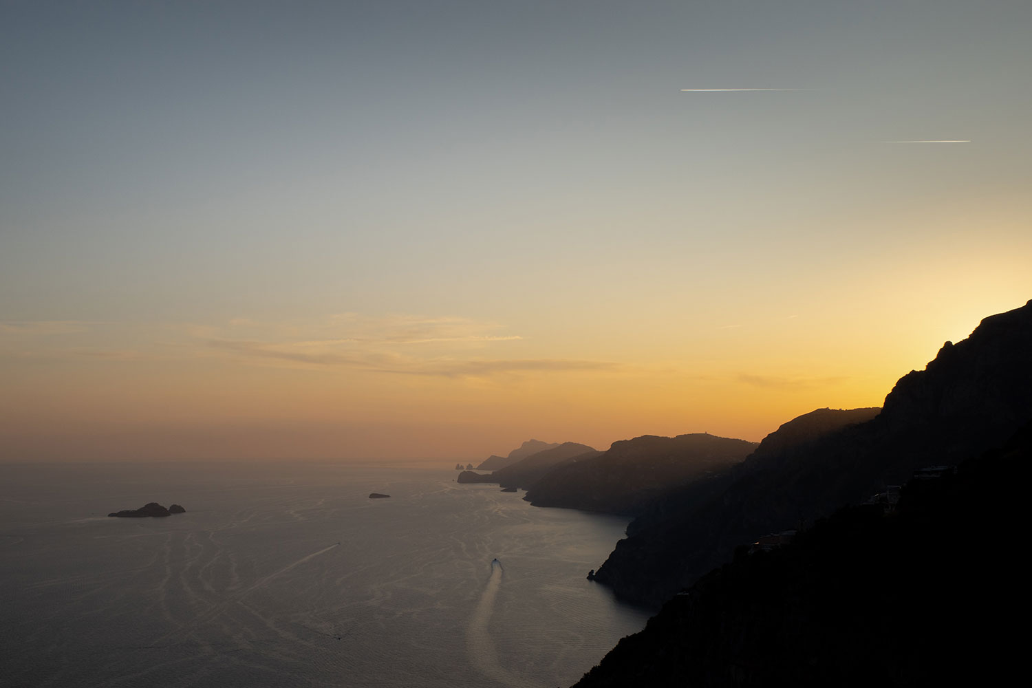
Starting in Bomerano, the Amalfi Coast slowly opens around you. Praiano sits far below, Li Galli stays out at sea, and Positano appears gradually as you move towards Nocelle.
What makes the walk so memorable is how clearly you begin to understand the landscape. Villages that look close together on a map are separated by steep ridges and deep folds in the mountains. Roads that feel dramatic from a bus suddenly look tiny from above.
Praiano is a good example. From the road, it can feel spread out and difficult to read. From the trail, you see how naturally it sits across the slope. Positano does the same thing, staying distant for much of the hike before slowly drawing closer near Nocelle.
And the best moments are often the quiet ones. Stop when the view opens, sit for a few minutes and let the light move across the coast.
Start in Bomerano, give the Path of the Gods a full morning, and do not rush it.

I spent 28 years on the Amalfi Coast. I write AmalfiMap to share the beaches, roads, restaurants and small practical details I would tell a friend before they came here. More about Marco →
Continue planning
Build the rest of the day around the walk.
The trail is simple once the transport around it makes sense. These are the useful next reads.